


Seoul Trail Course 4 runs 7.7 km from Hwarangdae Station to Kkalddak-gogae on Yongmasan, and it's rated beginner, the easiest of the three levels. We walked it over the Chuseok holiday in September 2026. On Mangu a family visiting a grave handed us a plate of jeon and a cup of cheongju, and after the skywalk we walked down to Sagajeong Market for makgeolli at an outdoor stall. This page follows the walk the way you'll see it.
| Distance | 7.7 km, one way |
|---|---|
| Level | Beginner |
| Time | About 3 hours by the official estimate. At an easy pace the walking took us about 2. |
| Start | Hwarangdae Station, Line 6, Exit 5 |
| End | Kkalddak-gogae Rest Area, about 1 km past the Yongmasan Skywalk. Walk down to Sagajeong Station, Line 7, Exit 4. |
| Toilets | Jungnang Camping Forest and Mangu History and Culture Park |
| Stamp boxes | Sinnae Eoul Park and Kkalddak-gogae Rest Area |
| Skywalk | Open 24 hours a day, per Seoul's official tourism site. The path to it is lit after dark. |
| Checked | September 28, 2026 |
You don't have to start at the start
The official course runs one way, but there are subway stations on both sides of the mountain, so you can pick the part you want.
Hwarangdae Station, Exit 5
Line 6. Walk the full 7.7 km, flat stream path first and the mountain last, and finish at the skywalk and Kkalddak-gogae.
Sagajeong Station
Line 7. The skywalk is about 2.4 km, or 50 minutes on foot, from here. This is the shortest way up if the view is what you came for.
Start on the mountain
Climb up from Sagajeong Station, walk the course backwards and finish on the flat stream path to Hwarangdae. You get the climb done while your legs are fresh.
Yongmasan Station
Line 7. Yongma Falls Park sits near this station on the official map, and you can go up Yongmasan from this side too.
We joined Course 4 from Course 5, starting at Gwangnaru Station and walking both courses backwards over two days, up over Achasan and Yongmasan to Mangu. Both days we set off at about 8 in the morning. Start that early and you can be sitting in a market by lunchtime.
From the stream to the skyline
A flat start along Mukdongcheon
Come out of Exit 5 and the first part is easy. The official map describes it as flat all the way along Mukdongcheon stream to Jungnang Camping Forest. You pass Bonghwasan Station and Yangwon Station on the way, so if you only want an hour of walking you can stop at either one. The first stamp box is at Sinnae Eoul Park.
Finding the wayFollow the orange ribbons
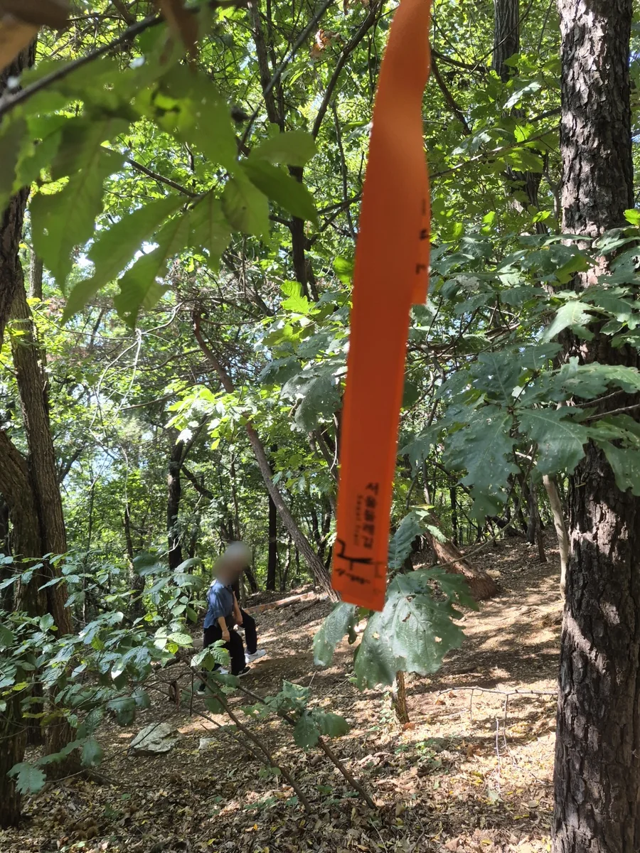
The route is easy to follow. Orange ribbons printed with 서울둘레길 (Seoul Trail) hang from branches along the way, and at the junctions there are wooden signposts in Korean and English, like the one at the top of this page. When the path splits, look for the next ribbon.
Picnic ground and the first toilets
This park was built on greenbelt land where greenhouses used to stand, and it's now a place for picnics and family days out. The official map marks toilets here. It's a good spot to eat something before the climb, because the path starts to go up after this.
Mangu History and Culture ParkA cemetery that became a park
A slight climb takes you into Mangu. This hillside was Seoul's public cemetery from 1933 until it filled up in 1973. Today it's a walking park with a 5.2 km path and memorial stones along the way. According to the official course page, the people buried here include independence activist Han Yong-un, Bang Jeong-hwan, who started Children's Day, the painter Lee Jung-seop and the poet Park In-hwan. There are toilets here too.
It's still a place where families come to look after their ancestors' graves. We walked through during Chuseok, and near Mangu a family visiting a grave saw us passing and handed us a plate of jeon and a cup of cheongju (clear rice wine). It was delicious. If someone offers you food like this, a grateful smile is all you need.
Deck path, or dirt if you want a hike
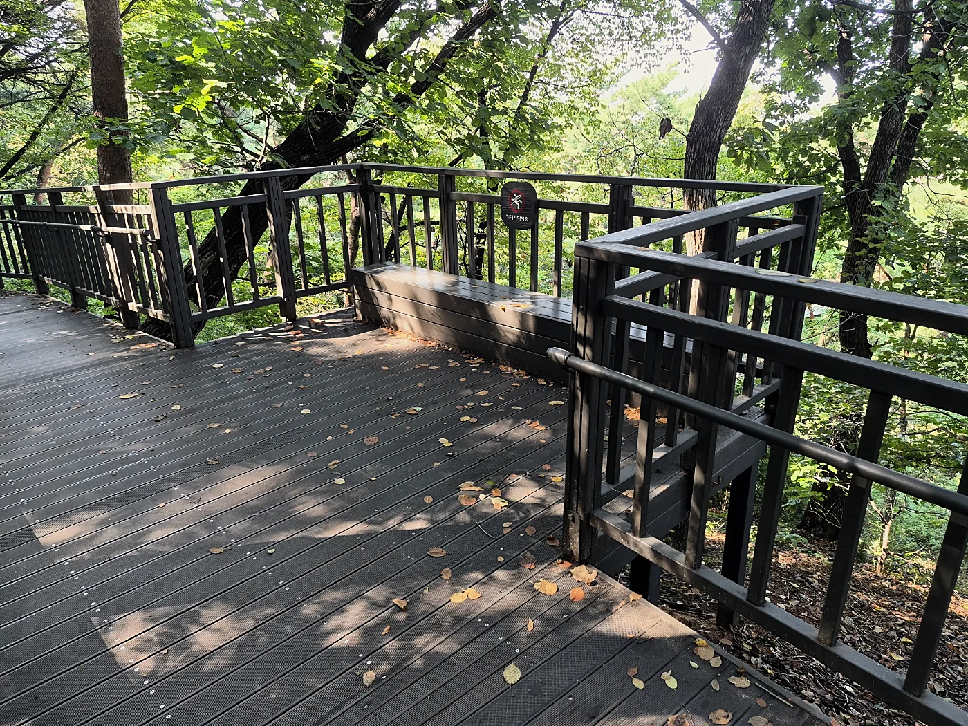
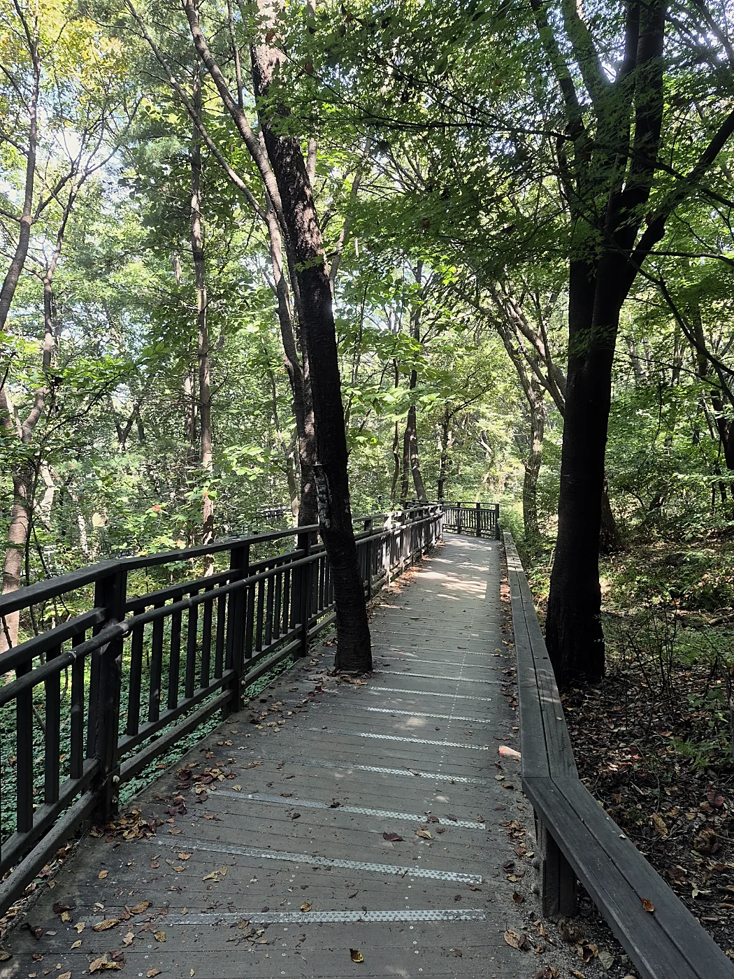
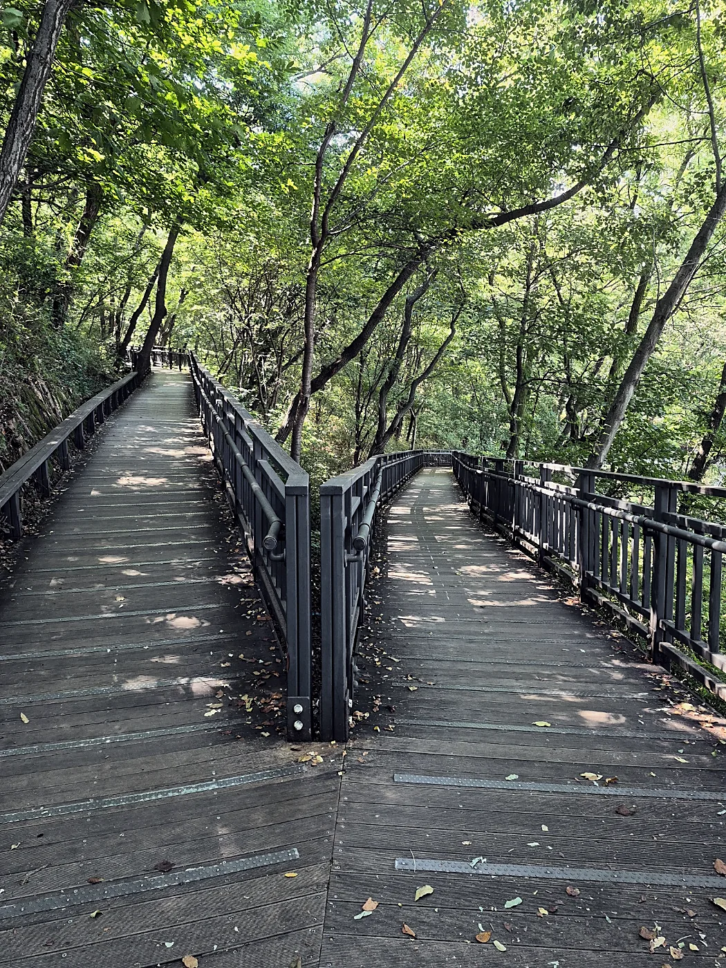
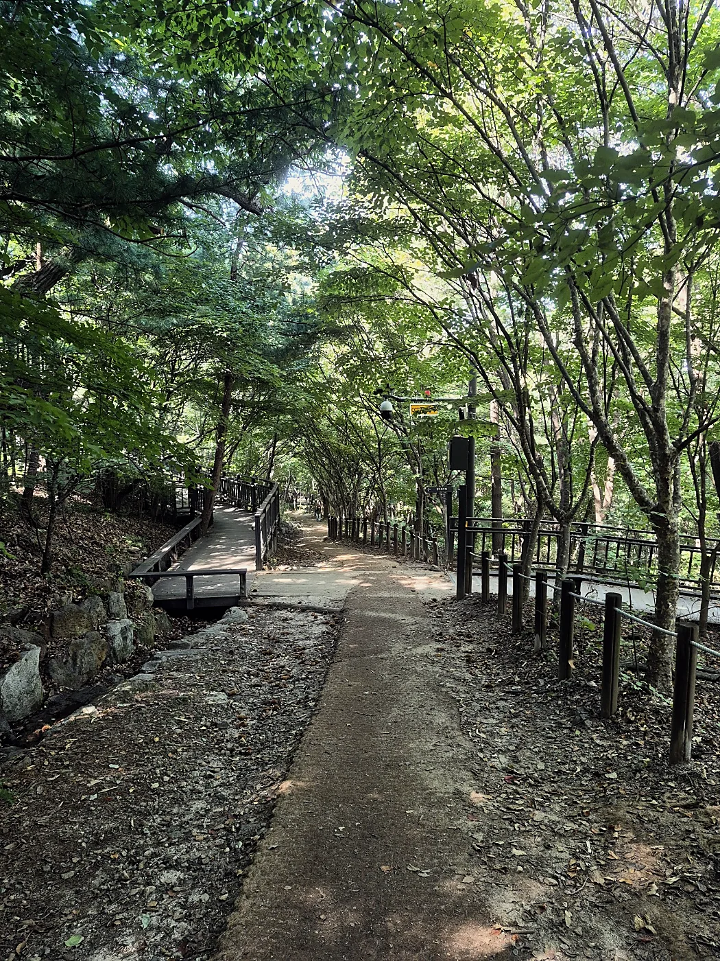
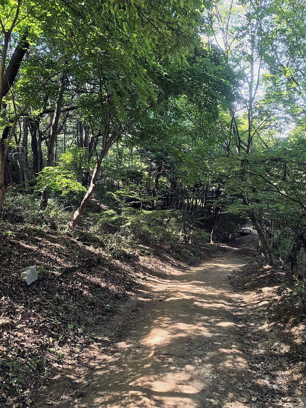
From Mangu the path follows the side of the mountain. On Yongmasan the main path is a wooden deck with railings, and it's easy going. If you want more of a hike, dirt trails leave the deck and climb through the forest. They have roots and rocks, so wear shoes with grip if you take them.
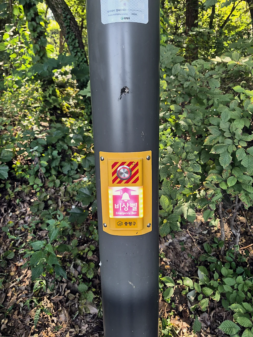
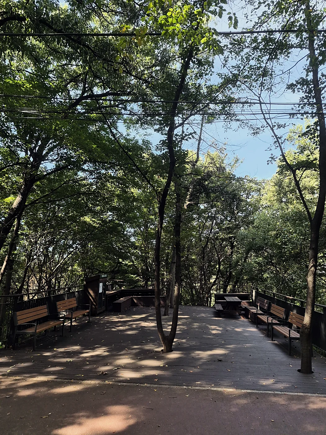
There are shaded rest decks with benches all along this part, CCTV and emergency bells on the poles (more on that below), and drinking springs (약수터). Check the posted water test result before you drink.
What the walking is like
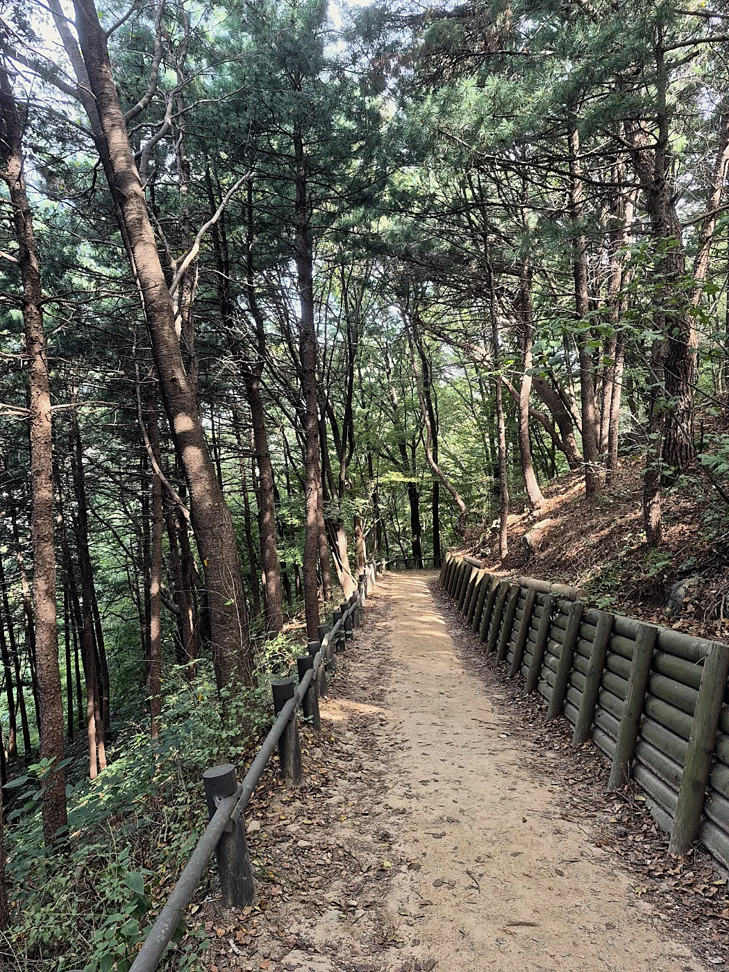
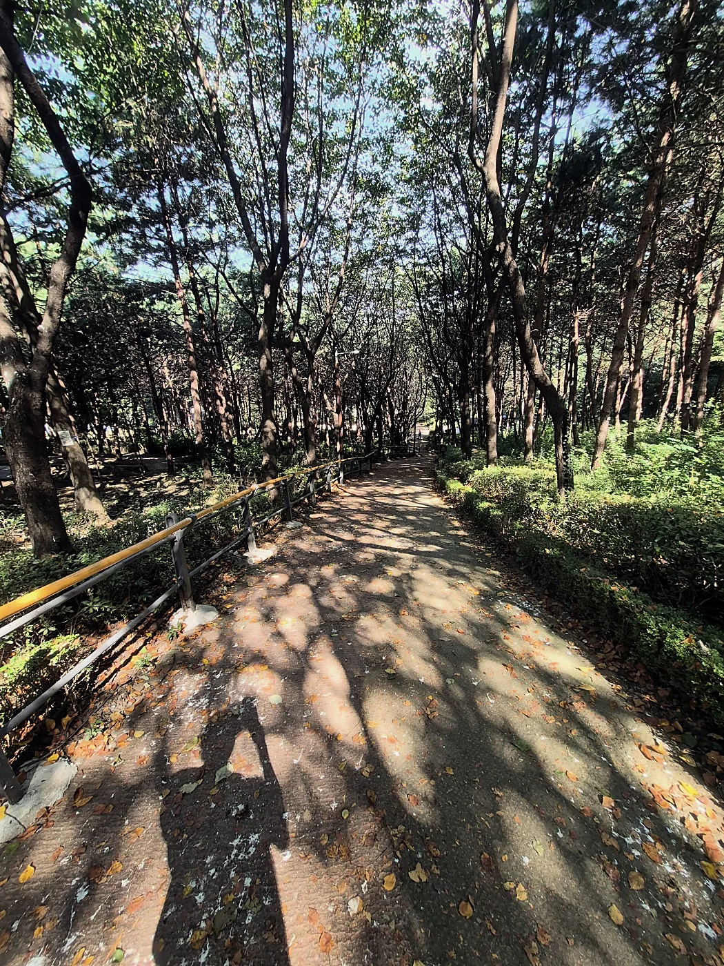
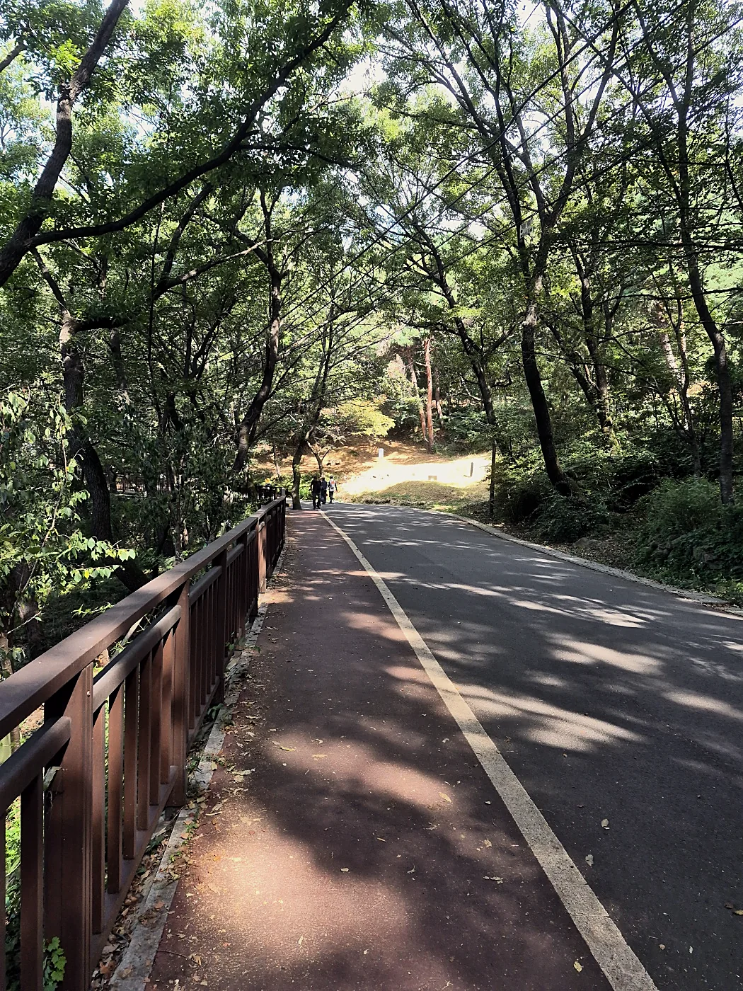
Most of Course 4 on Yongmasan is in the shade. There are wide dirt paths with handrails, deck paths that split and join again, a paved forest road for a stretch, and quiet pine sections with log fences. In late September the light came through the leaves in patches, and the whole path was covered in leaf shadows.
Take your shoes off. Really.
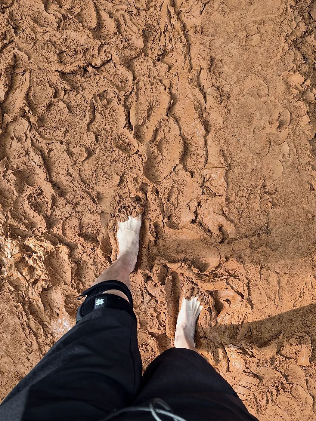
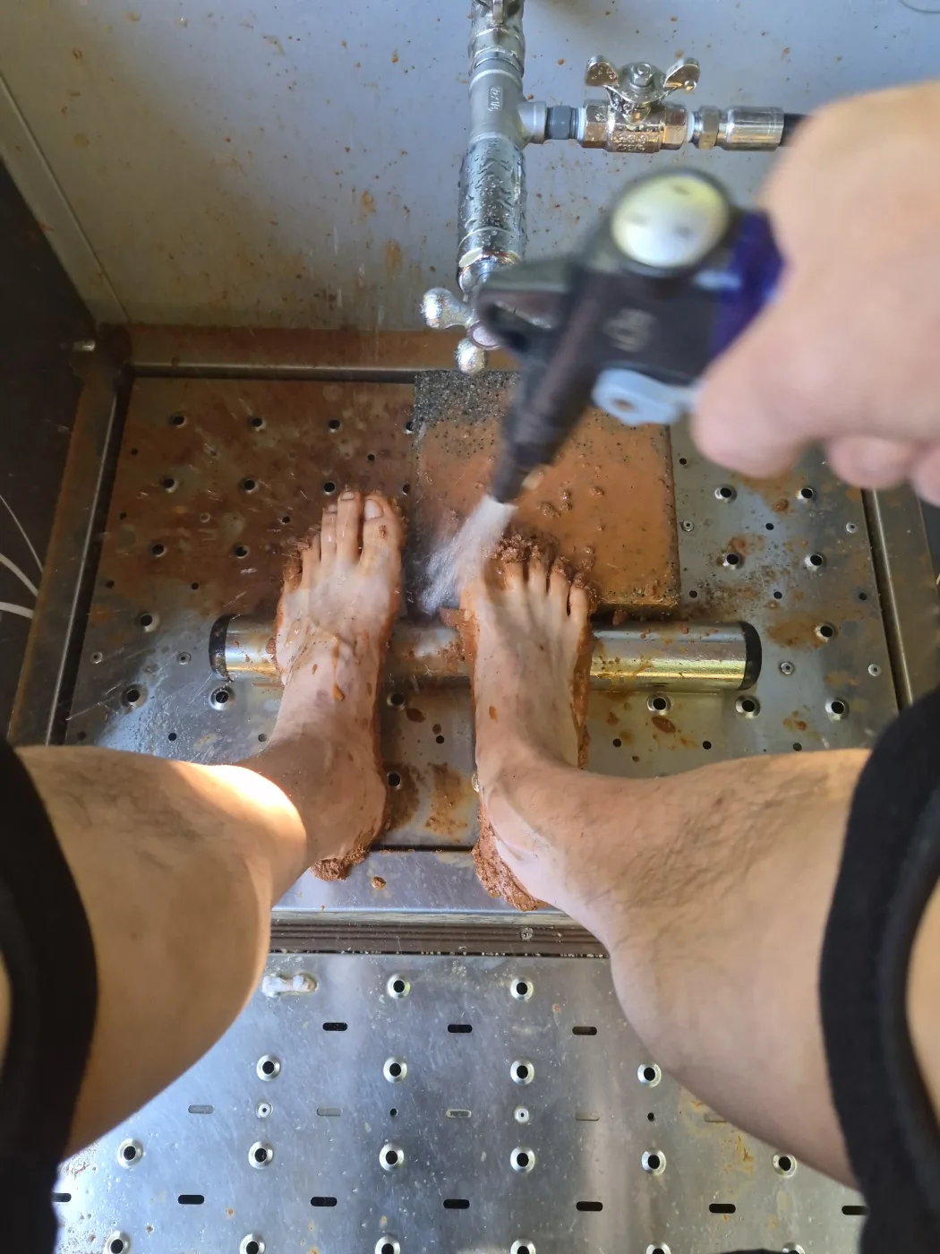
Yongmasan has a red clay path for walking barefoot, and this was one of our favorite parts of the day. We took our shoes off and the clay was cool and soft under our feet. The bumps in the path press into the soles of your feet like a foot massage, and by the end we were in a noticeably better mood than when we started.
You don't need to bring anything special. When you're done there's a foot-washing station right next to the path with taps and stools, so you can rinse off and put your shoes back on. A small towel makes it easier. We got there early, and the only other people at the foot wash were a mother and her elementary-school kid, who was drying off their feet.
Yongmasan Skywalk: the view you came for
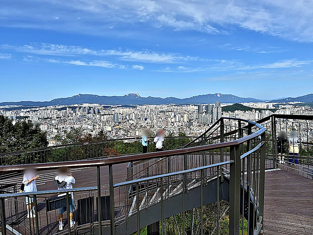
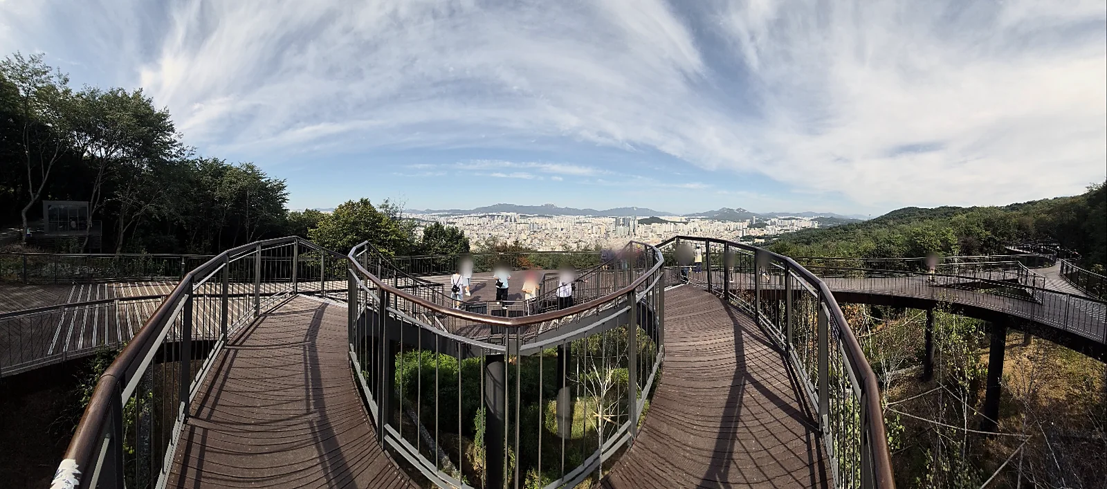
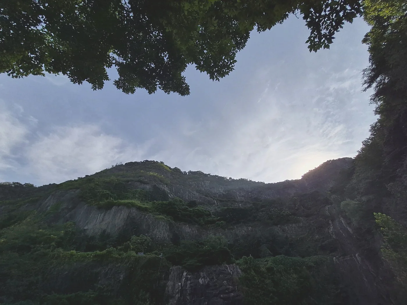
Then the trees open up. The skywalk, opened by the city in November 2025, is a 160 m wooden deck that runs about 10 m above the forest floor. From the highest point you look across northeast Seoul, a sea of apartment blocks, with the Bukhansan ridge behind it and Dobongsan, Bonghwasan and N Seoul Tower in the distance. On a clear day you can pick out the granite peaks of Bukhansan. With no clouds at all, it looks like you could see from Gwanaksan in the south all the way to Dobongsan in the north.
Last stamp, then down to the market
A little further on is Kkalddak-gogae Rest Area, the end of Course 4 and the second stamp box. "Kkalddak-gogae" is a name Koreans use for a steep pass that leaves you out of breath, and it's the only part of Course 4 that earns the name. Everything else felt easy. We came the other way round, so for us it was downhill. Course 5 to Achasan starts right here. If you're done for the day, the official route down goes to Sagajeong Park by stone stairs and on to Sagajeong Station, and on the way you walk into Sagajeong Market. For the market we'd pick, ride one stop on Line 7 to Myeonmok and go to Dongwon Market.
Cameras, bells and first aid
On both days we kept passing safety equipment put there by the district offices, and most of it carries a Jungnang-gu or Gwangjin-gu logo. These are the things we saw on Yongmasan and on the Achasan side.
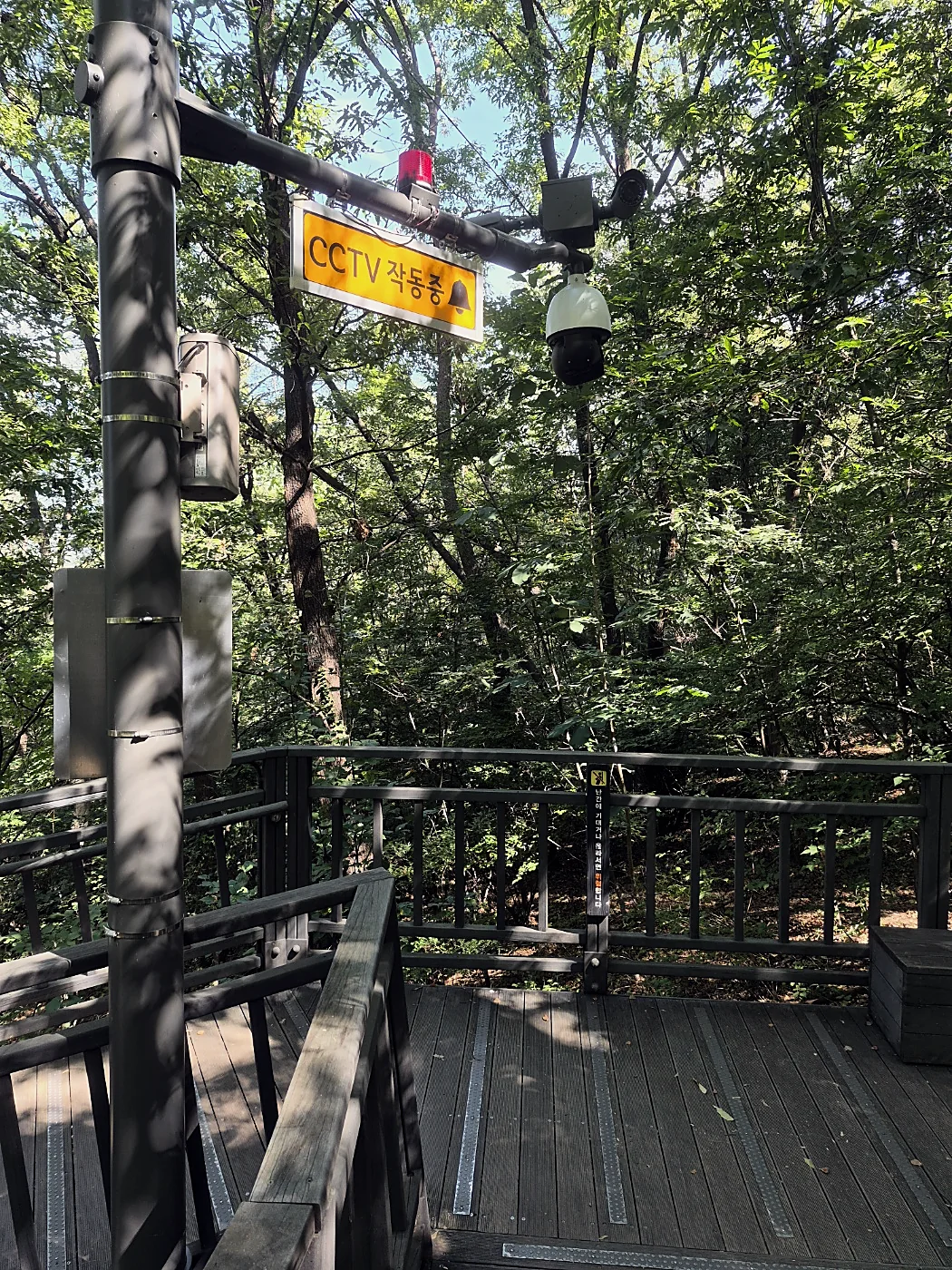
CCTV
Cameras over the deck path on Yongmasan. The sign next to them says they record 24 hours and are run by Jungnang-gu's CCTV control center together with the Jungnang police station.
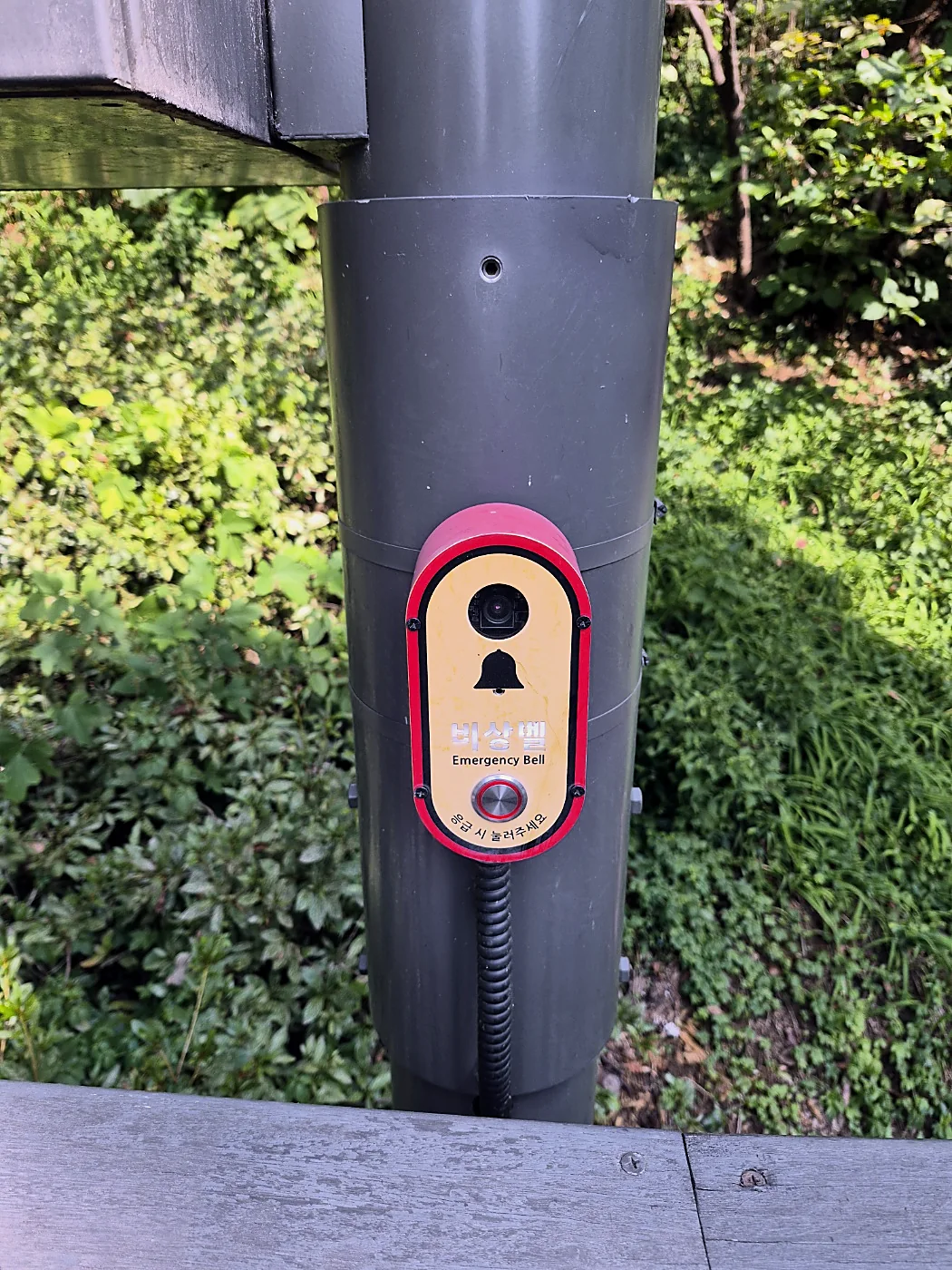
Emergency bells
Buttons on the poles marked 비상벨, Emergency Bell. If you need help, press it.
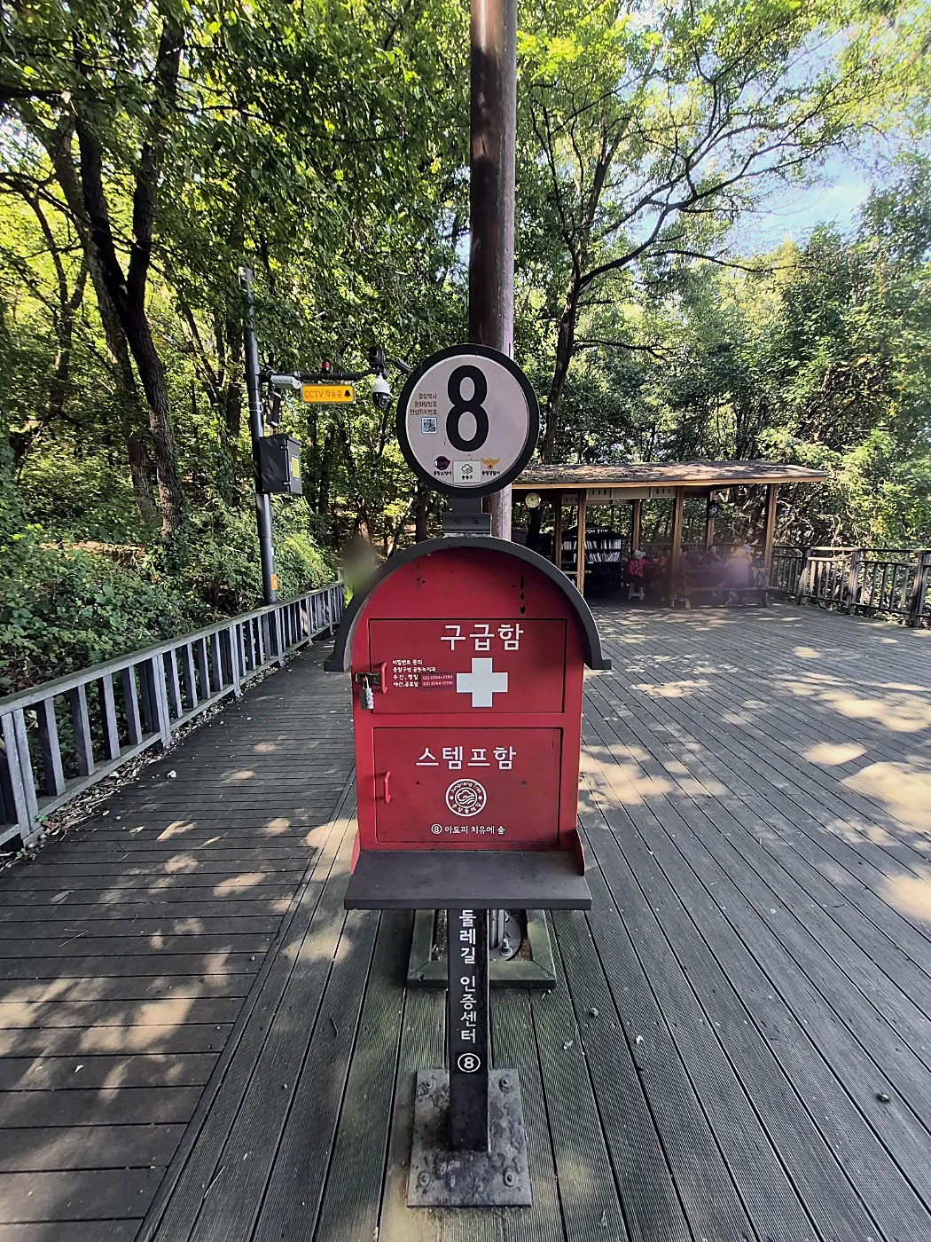
First-aid boxes
On Yongmasan the box is locked, and the Jungnang-gu Office numbers for the code are printed on the front. On the Achasan side the box says anyone can use it in an emergency.
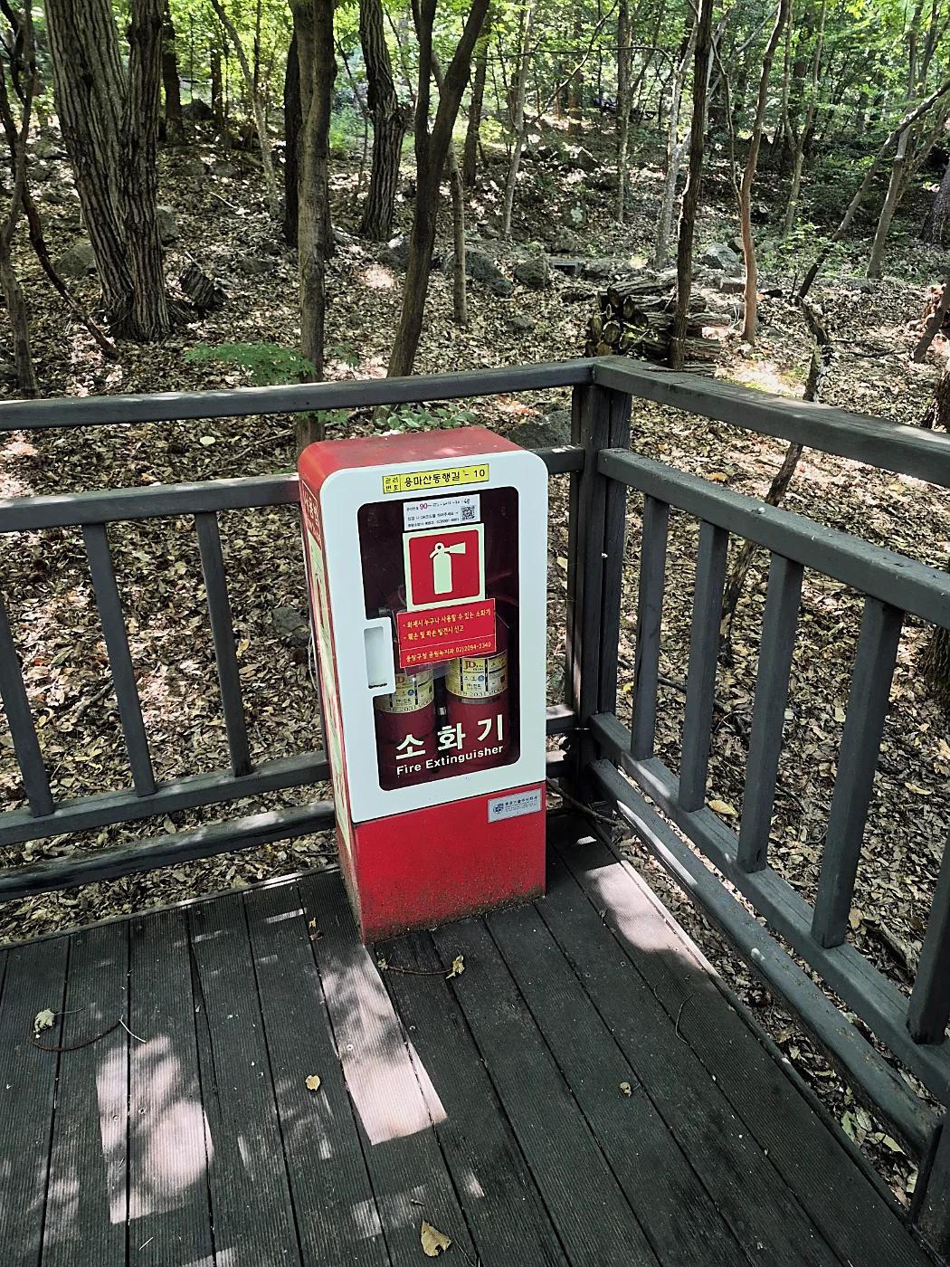
Fire extinguishers
Extinguisher boxes on the decks, with picture instructions on how to use them. There are larger wildfire equipment cabinets on Achasan too.
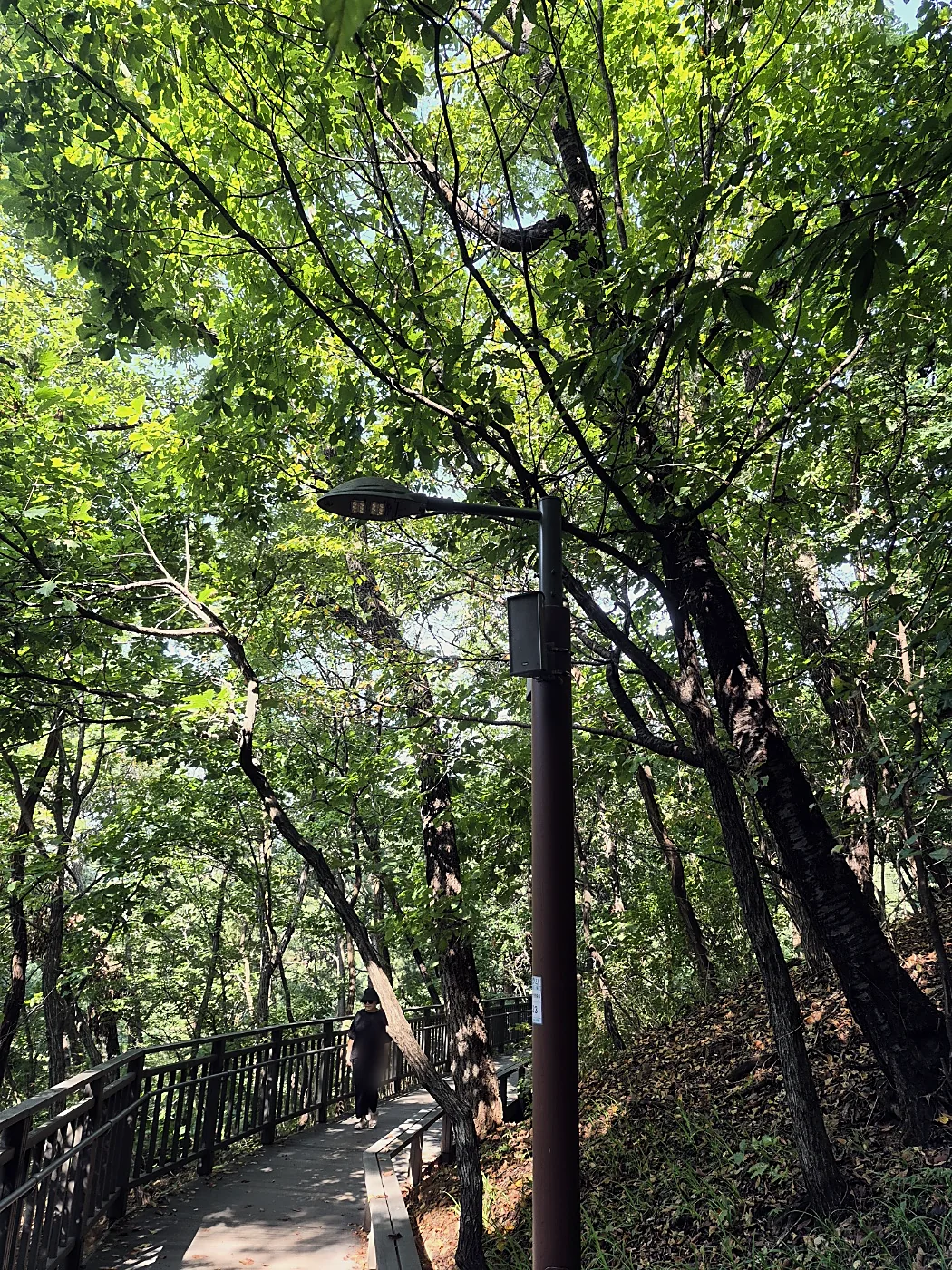
Lights
Lamps along the deck paths. The path to the skywalk is lit after dark, and you can go up at night.
Free Wi-Fi
Some poles on Yongmasan have a Seoul public Wi-Fi sticker (PublicWiFi@Jungnang), handy if your data runs low.
If something goes wrong
119Fire and ambulance. Tell them the nearest landmark, for example "Yongmasan Skywalk" or "Kkalddak-gogae".
Seoul Ansimi app (서울안심이): press the emergency button or shake your phone, and the district CCTV control center can see your location. It only works in Seoul.
Or press the nearest emergency bell.
Good to know before you go
Freeze it the night before
We bought bottled water the day before and put two bottles in the freezer. It melts as you walk, and the water is cold and refreshing.
Two candies
We carried them in case of low blood sugar. We didn't need them, because this isn't a climb to a summit.
Count your steps
Turn on a step counter, the one built into your Galaxy or iPhone or any walking app. Watching the number go up makes the walk more fun.
Dogs are welcome
You can bring your dog on Courses 4 and 5, and on Achasan you can take them all the way to the top. Keep them on a leash, and bring poop bags every time.
Jeon, makgeolli and a free afternoon
This is the part a lot of Korean hikers look forward to all day. You come down off the mountain a little tired and a little dusty, sit on a plastic stool in a market, and order a plate of hot jeon (savory pancakes) and a cold bottle of makgeolli (rice wine) in the early afternoon. Korean has a word for drinking in the daytime, natsul (낮술), and after a morning on the trail nobody will judge you for it.
Our plan was to see the skywalk, walk down through Sagajeong Park and have jeon and makgeolli in Sagajeong Market. It was Chuseok, though, and after a holiday of jeon we couldn't face another plate, so we sat at an outdoor stall with an old-market feel and ordered hongeo-muchim instead: fresh skate, not the fermented kind, tossed with doraji root, cucumber and minari in a sweet and sour chili sauce. It was cool, clean and not spicy, and it went really well with the makgeolli. We took a taxi home, very happy. Koreans say makgeolli goes with pajeon on rainy days, because the sizzle of the pan sounds like rain, but you don't need rain to try it. You won't be the only hiker there either: when Sisa Prime visited Sagajeong Market in 2023, it noted hikers from Yongmasan among the shoppers. The one rule is to save it for the bottom, because Seoul Trail etiquette asks walkers not to drink on the trail.
Dongwon Market
If you only go to one market, go here. It's big, the prices are low and there's a lot to choose from. It has about 123 shops, and it's one or two minutes from Myeonmok Station Exit 1 on Line 7, one stop from Sagajeong. There's a food alley where the gopchang (grilled intestines) sizzles on hot plates, and jokbal and pyeonyuk (sliced pork) shops. The official map puts it 1.9 km (about 29 minutes) from the trail. On Naver Map, search 동원시장.
Sagajeong Market
About 130 shops, running from Sagajeong Station toward the crosswalk for the Yongmasan trail, so you walk through it on the way down. This is where we ate, at an outdoor stall. It started as a street market in 1970. Look for sundaeguk (sausage soup), dakgangjeong (sweet fried chicken), grilled eel and charcoal dakgalbi, plus jeon shops that serve makgeolli. The official map lists Exit 2 and 1.2 km (about 17 minutes) from the trail. On Naver Map, search 사가정시장.
Gongneung Dokkaebi Market
It grew out of street stalls that gathered by the old Gyeongchun Line station at Hwarangdae after the railway opened in 1939. The stalls vanished when inspectors came and reappeared when they left, like dokkaebi (Korean goblins), hence the name. It has an arcade roof, so it works on a rainy day. The nearest subway is Gongneung Station, Line 7, Exit 2, about a 7-minute walk. On Naver Map, search 공릉동 도깨비시장.
How to order and drink like a local
- Order a mixed plate, 모둠전 (modeum-jeon), to share. Pajeon (green onion pancake) and kimchi-jeon are the classics.
- Ask for 막걸리 한 병 (makgeolli han byeong), one bottle. In many jeon shops it comes with small bowls instead of glasses.
- The sediment sinks to the bottom, so give the bottle a gentle turn before you open it. Most makgeolli is around 6% alcohol, lighter than soju, but it adds up on an empty stomach, so eat the jeon.
- Pour for the people you're with, not for yourself, and hold the bottle with two hands when you pour for someone older. Say "jjan!" when you clink bowls.
- If you want to skip the hangover, ask for makgeolli without aspartame: "노 아스파탐 막걸리 주세요" (no aspartame makgeolli juseyo). Many makgeolli fans say the kind without sweeteners is gentler the next day. It isn't proven by research, but it's worth asking, or check the label for 아스파탐.
- If you don't drink, just eat your way through the market, or grab an iced coffee. There's usually a café close by.
Phrases for the table
Market details: official Course 4 map (distances and exits), Sisa Prime (Sagajeong Market, September 2023), Newslock (Dongwon Market, August 2025) and Korea Tourism Organization (Gongneung Dokkaebi Market). Shops change, so treat the food list as a guide.
Where everything is
Schematic, not to scale. Positions follow the official Seoul Trail Course 4 map. Use Naver Map or Kakao Map for turn-by-turn directions. On a phone, swipe the map sideways.
Places to sit down
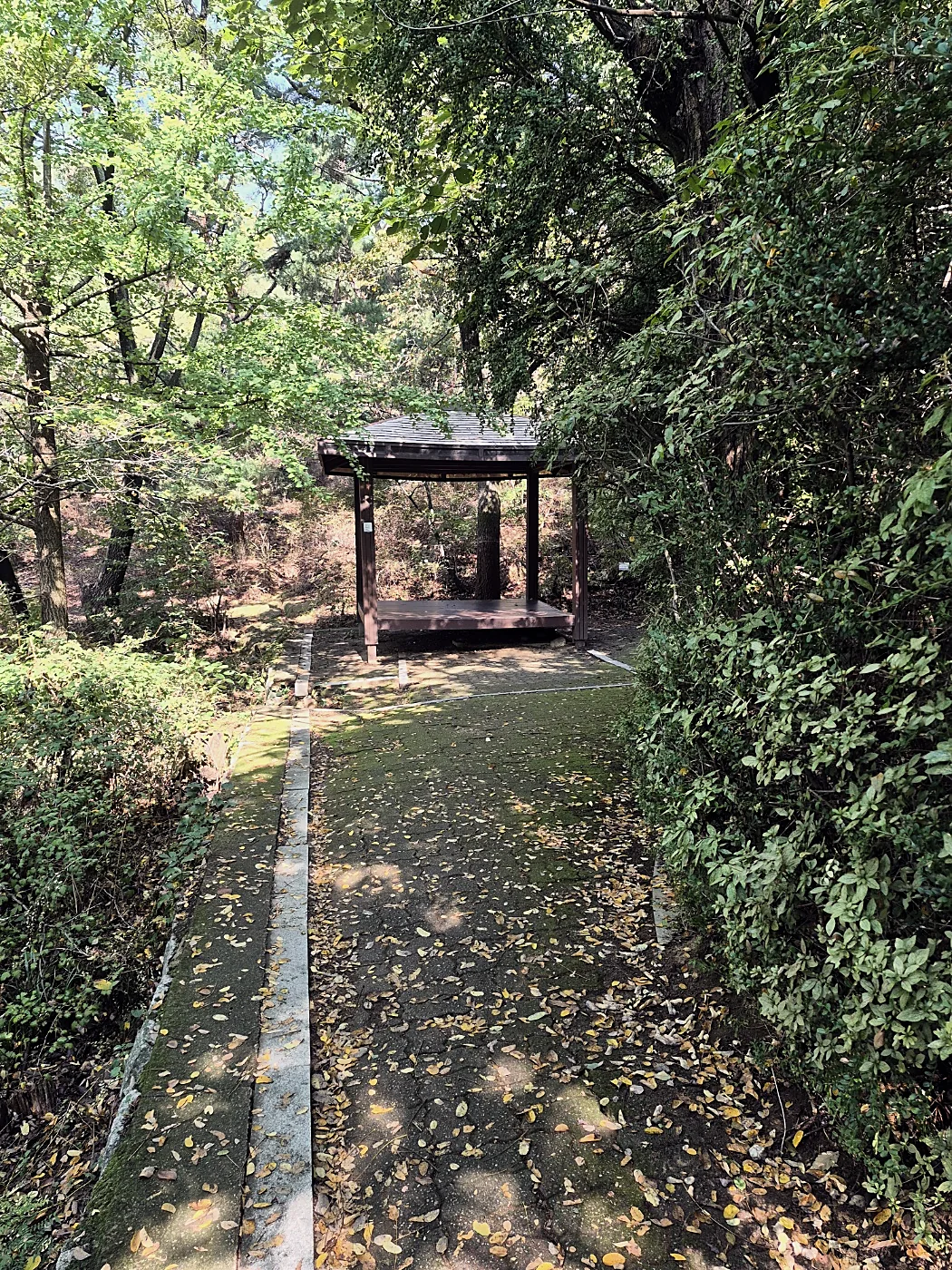
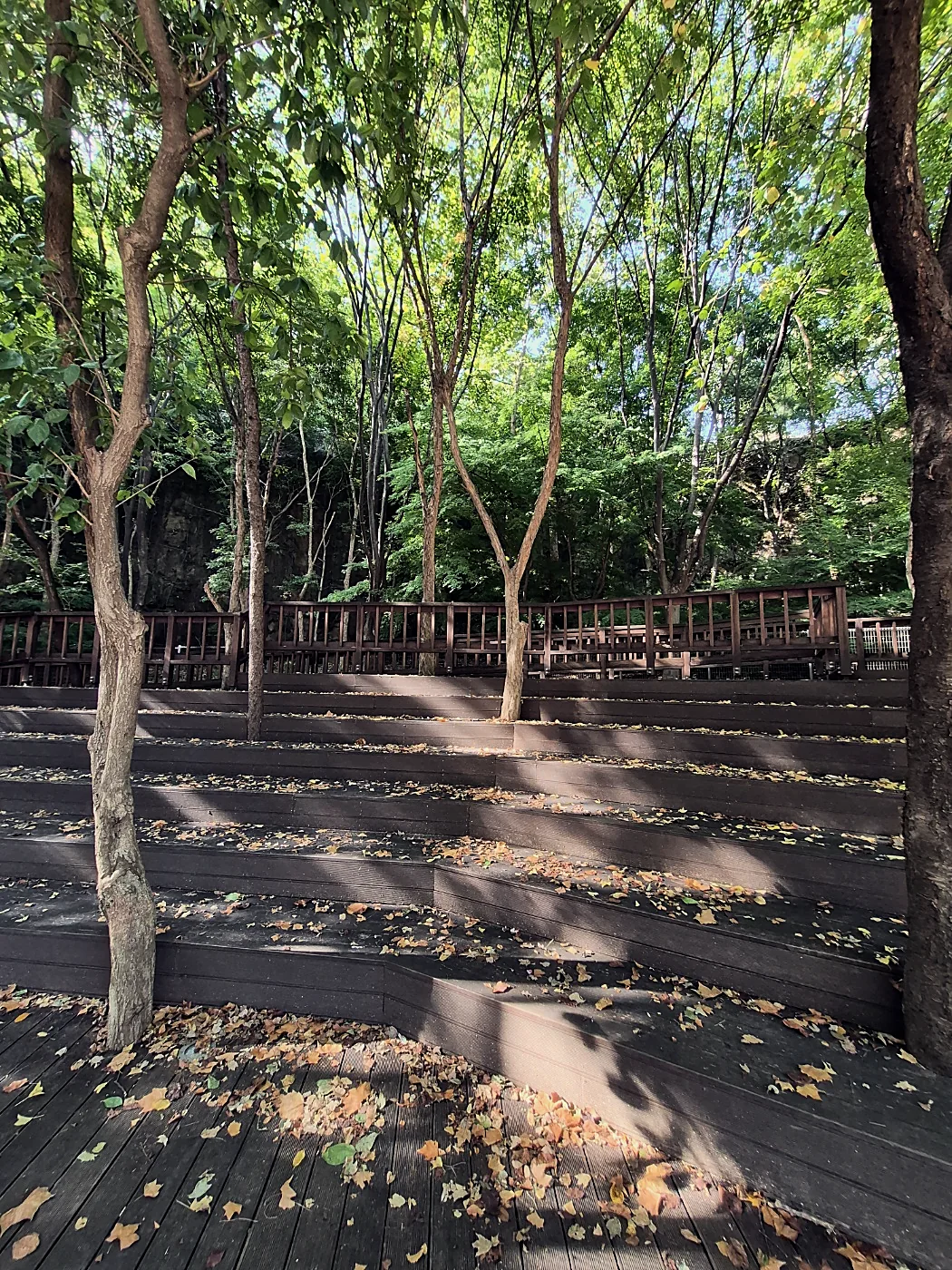
One of the nice things about this walk is how often you find somewhere to stop: roofed rest areas, pavilions, decks with benches and tables, and log seats under the pines. These are the ones we used over our two days on Yongmasan and Achasan.
Yongma Falls Park
At the foot of Yongmasan near Yongmasan Station, and not on the official route. The cliffs were a gravel quarry, and the district turned them into a park with three artificial waterfalls. The biggest is 51.4 m. The falls only run from May 1 to August 31, at set times, and not in the rain. We came in late September and saw bare rock, which is still a big sight from below.
Source: Jungnang-gu Office · 02-2094-2353
Korean you'll see on the trail
Common questions
How long is Seoul Trail Course 4?
7.7 km, and the official estimate is about 3 hours. It's rated beginner, the easiest of the three levels.
Where does Course 4 start and end?
It starts at Hwarangdae Station, Line 6, Exit 5, and ends at Kkalddak-gogae Rest Area on Yongmasan. From there, walk down to Sagajeong Station, Line 7, Exit 4.
Where are the toilets on Course 4?
The official course map marks toilets at Jungnang Camping Forest and at Mangu History and Culture Park.
How do I get to the Yongmasan Skywalk?
The closest subway is Sagajeong Station on Line 7, about 2.4 km or 50 minutes on foot. From Hwarangdae Station along Course 4 it's about 6.6 km. There's no car access.
How long does Course 4 really take?
The official estimate is about 3 hours. At an easy pace the walking took us about 2 hours, not counting stops.
Is Seoul Trail Course 4 safe?
On the Yongmasan section we saw CCTV cameras, emergency bells, first-aid boxes and fire extinguishers, and the path to the skywalk is lit at night. In an emergency call 119, or use the Seoul Ansimi app.
Can I visit the Yongmasan Skywalk at night?
Yes. Seoul's official tourism site lists the skywalk as open 24 hours a day, and the lamps along the path come on after dark.
Can I bring my dog on Course 4?
Yes. Dogs are fine on Courses 4 and 5. Keep them on a leash, and bring poop bags.
How do I find the way on Course 4?
Follow the orange ribbons printed with 서울둘레길 (Seoul Trail) that hang from branches along the route. At junctions there are wooden signposts in Korean and English.
Where can I eat after Seoul Trail Course 4?
Sagajeong Market is on the way down to Sagajeong Station. Dongwon Market is one stop away on Line 7, at Myeonmok Station, and it has the most choice.
Trail conditions and routes can change. Check the official course page before you go.
- Seoul Trail, Course 4 page and course map (Seoul Metropolitan Government, KOGL Type 1): distance, time, level, start and end, toilets, stamp boxes, market distances.
- Seoul Metropolitan Government, November 20, 2025: skywalk length, height and access.
- Visit Seoul, Yongmasan Skywalk Observatory: opening hours.
- Everything else on this page is from our own walk on September 25 and 26, 2026. All checked September 28, 2026.
Written by OK Recruiting. We help English teachers find work at schools in Korea. Current openings